
Khangkhu topographic map
Interactive map
Click on the map to display elevation.
About this map
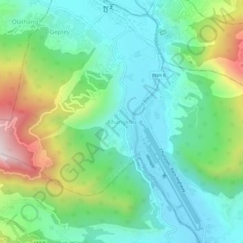
Name: Khangkhu topographic map, elevation, terrain.
Location: Khangkhu, Paro Dzongkhag, Paro District, 12001, Bhutan (27.39200 89.39551 27.43200 89.43551)
Average elevation: 2,454 m
Minimum elevation: 2,219 m
Maximum elevation: 3,034 m