
Ban Nong Sarai topographic map
Interactive map
Click on the map to display elevation.
About this map
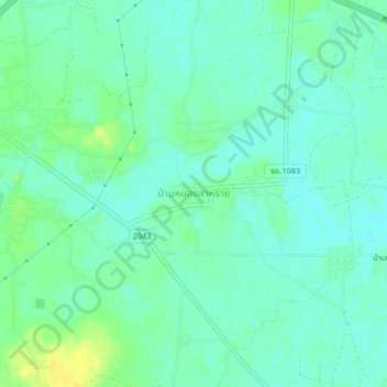
Name: Ban Nong Sarai topographic map, elevation, terrain.
Location: Ban Nong Sarai, Roi Et Province, Thailand (16.00655 103.68491 16.04655 103.72491)
Average elevation: 142 m
Minimum elevation: 134 m
Maximum elevation: 156 m