
Rhêmes-Notre-Dame topographic map
Interactive map
Click on the map to display elevation.
About this map
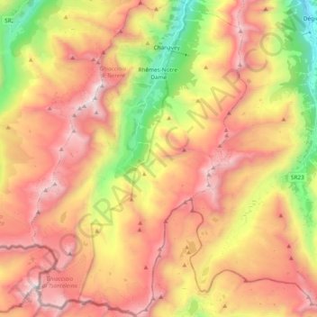
Name: Rhêmes-Notre-Dame topographic map, elevation, terrain.
Location: Rhêmes-Notre-Dame, Valle d'Aosta, Italia (45.46695 7.04254 45.59917 7.17040)
Average elevation: 2,628 m
Minimum elevation: 1,511 m
Maximum elevation: 3,580 m