
Mandaf topographic map
Interactive map
Click on the map to display elevation.
About this map
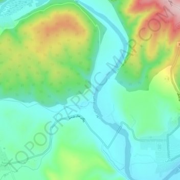
Name: Mandaf topographic map, elevation, terrain.
Location: Mandaf, Aqrah District, Dohuk, Iraqi Kurdistan, Iraq (36.85883 44.02354 36.89883 44.06354)
Average elevation: 543 m
Minimum elevation: 457 m
Maximum elevation: 748 m