
Hopkins topographic map
Interactive map
Click on the map to display elevation.
About this map
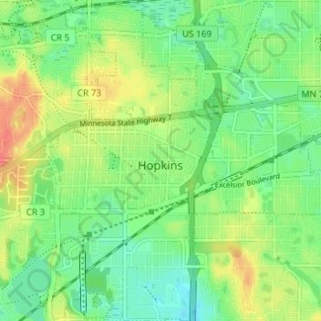
Name: Hopkins topographic map, elevation, terrain.
Location: Hopkins, Hennepin County, Minnesota, 55343, United States (44.90606 -93.42952 44.94925 -93.37081)
Average elevation: 284 m
Minimum elevation: 264 m
Maximum elevation: 313 m