
Chrudim topographic map
Interactive map
Click on the map to display elevation.
About this map
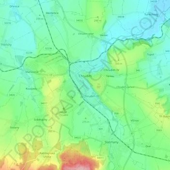
Name: Chrudim topographic map, elevation, terrain.
Location: Chrudim, okres Chrudim, Pardubický kraj, Northeast, Czechia (49.90858 15.74728 49.98531 15.86129)
Average elevation: 276 m
Minimum elevation: 233 m
Maximum elevation: 390 m