
Kowloon City District topographic map
Interactive map
Click on the map to display elevation.
About this map
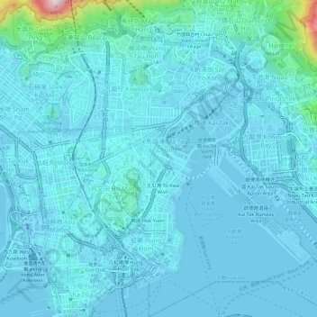
Name: Kowloon City District topographic map, elevation, terrain.
Location: Kowloon City District, Kowloon, Hong Kong, China (22.29411 114.17273 22.34933 114.21938)
Average elevation: 37 m
Minimum elevation: -31 m
Maximum elevation: 438 m
Other topographic maps
Click on a map to view its topography, its elevation and its terrain.
Kwun Tong District
Kwun Tong District, Kowloon, Hong Kong, China
Average elevation: 61 m
Kowloon Walled City Park
Kowloon Walled City Park, Kau Pui Shek, Kowloon City, Kowloon City District, Kowloon, Hong Kong, China
Average elevation: 28 m
Jordan Valley
Jordan Valley, Shun On Road, Choi Wan, Jordan Valley, Kowloon, Kwun Tong District, Hong Kong, China
Average elevation: 107 m