
Rupnagar topographic map
Click on the map to display elevation.
About this map
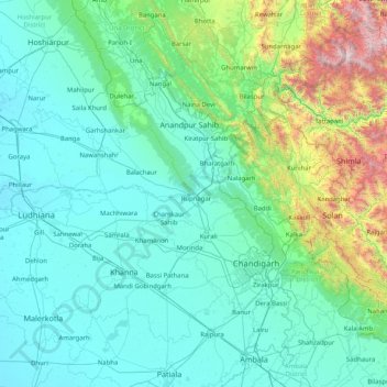
Name: Rupnagar topographic map, elevation, terrain.
Location: Rupnagar, Rupnagar District, Punjab, India (30.28333 75.81667 31.68333 77.21667)
Average elevation: 598 m
Minimum elevation: 232 m
Maximum elevation: 3,314 m
Other topographic maps
Click on a map to view its topography, its elevation and its terrain.