
Nantgwynant topographic map
Interactive map
Click on the map to display elevation.
About this map
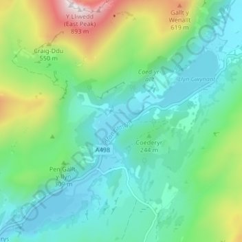
Name: Nantgwynant topographic map, elevation, terrain.
Average elevation: 264 m
Minimum elevation: 52 m
Maximum elevation: 873 m
Other topographic maps
Click on a map to view its topography, its elevation and its terrain.
Snowdonia
United Kingdom > Wales > Gwynedd > Beddgelert
Snowdonia, Beddgelert, Gwynedd, Wales, LL55 4UL, United Kingdom
Average elevation: 700 m
Llyn Gwynant
United Kingdom > Wales > Gwynedd > Beddgelert > Nantgwynant
Llyn Gwynant, Nantgwynant, Beddgelert, Gwynedd, Wales, United Kingdom
Average elevation: 245 m