
Cymmer topographic map
Interactive map
Click on the map to display elevation.
About this map
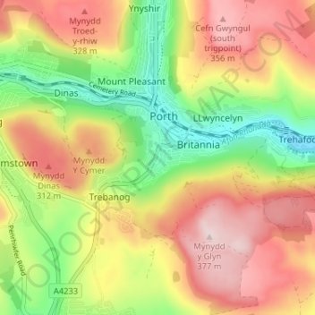
Name: Cymmer topographic map, elevation, terrain.
Location: Cymmer, Rhondda Cynon Taf, Wales, CF39 9AT, United Kingdom (51.58720 -3.42976 51.62720 -3.38976)
Average elevation: 227 m
Minimum elevation: 73 m
Maximum elevation: 377 m