
Königslutter topographic map
Interactive map
Click on the map to display elevation.
About this map
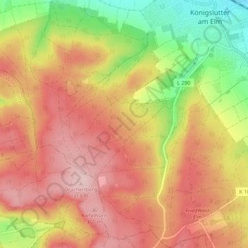
Name: Königslutter topographic map, elevation, terrain.
Location: Königslutter, Landkreis Helmstedt, Lower Saxony, Germany (52.20424 10.76385 52.25323 10.82609)
Average elevation: 240 m
Minimum elevation: 121 m
Maximum elevation: 327 m