
เกาะล้าน topographic map
Interactive map
Click on the map to display elevation.
About this map
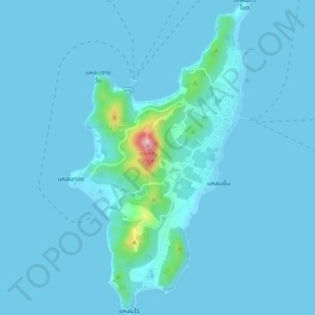
Name: เกาะล้าน topographic map, elevation, terrain.
Location: เกาะล้าน, พัทยา, จังหวัดชลบุรี, Thailand (12.89738 100.76648 12.93760 100.79033)
Average elevation: 11 m
Minimum elevation: 0 m
Maximum elevation: 194 m
Other topographic maps
Click on a map to view its topography, its elevation and its terrain.