
Saint Anthony topographic map
Interactive map
Click on the map to display elevation.
About this map
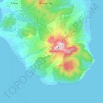
Name: Saint Anthony topographic map, elevation, terrain.
Location: Saint Anthony, Montserrat (16.67444 -62.24191 16.73671 -62.14419)
Average elevation: 150 m
Minimum elevation: -8 m
Maximum elevation: 902 m
Other topographic maps
Click on a map to view its topography, its elevation and its terrain.