
Tinum topographic map
Interactive map
Click on the map to display elevation.
About this map
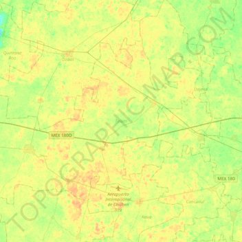
Name: Tinum topographic map, elevation, terrain.
Location: Tinum, Yucatán, Mexico (20.61735 -88.69644 20.86497 -88.31328)
Average elevation: 25 m
Minimum elevation: 12 m
Maximum elevation: 34 m
Other topographic maps
Click on a map to view its topography, its elevation and its terrain.
Palomar
Mexico > Yucatán > Valladolid
Palomar, Valladolid, Yucatán, 97785, Mexico
Average elevation: 21 m
Chicxulub Puerto
Mexico > Yucatán > Progreso > Chicxulub Puerto
Chicxulub Puerto, Progreso, Yucatán, Mexico
Average elevation: 0 m
San Felipe Nuevo
San Felipe Nuevo, Tinum, Yucatán, 97751, Mexico
Average elevation: 27 m