
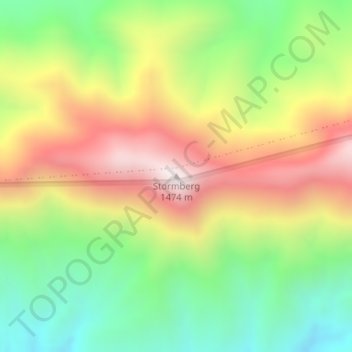
Stormberg topographic map
Interactive map
Click on the map to display elevation.
About this map
Name: Stormberg topographic map, elevation, terrain.
Average elevation: 962 m
Minimum elevation: 547 m
Maximum elevation: 1,461 m
Other topographic maps
Click on a map to view its topography, its elevation and its terrain.
Wilderness
South Africa > Western Cape > Garden Route District Municipality > George Local Municipality
Wilderness, George Local Municipality, Garden Route District Municipality, Western Cape, 6560, South Africa
Average elevation: 69 m
George
South Africa > Western Cape > Garden Route District Municipality > George Local Municipality > George
George, George Local Municipality, Garden Route District Municipality, Western Cape, 6529, South Africa
Average elevation: 244 m