
Qadis topographic map
Interactive map
Click on the map to display elevation.
About this map
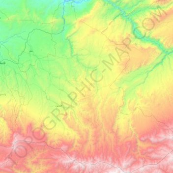
Name: Qadis topographic map, elevation, terrain.
Location: Qadis, Badghis, Afghanistan (34.51324 63.18498 35.25793 64.06627)
Average elevation: 1,639 m
Minimum elevation: 589 m
Maximum elevation: 3,282 m
Other topographic maps
Click on a map to view its topography, its elevation and its terrain.
Darreh-ye Galleh Cheshmeh;Darrah-i-Gala Casma;Darah-ye Galah Chashmah
Darreh-ye Galleh Cheshmeh;Darrah-i-Gala Casma;Darah-ye Galah Chashmah, Murghab, Badghis, Afghanistan
Average elevation: 816 m