
Gualtar topographic map
Interactive map
Click on the map to display elevation.
About this map
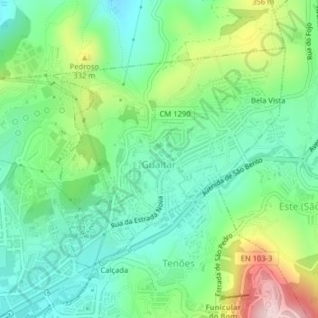
Name: Gualtar topographic map, elevation, terrain.
Location: Gualtar, Braga, Cávado, North, Portugal (41.55705 -8.40110 41.57597 -8.37374)
Average elevation: 246 m
Minimum elevation: 151 m
Maximum elevation: 456 m