
Chivor topographic map
Interactive map
Click on the map to display elevation.
About this map
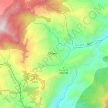
Name: Chivor topographic map, elevation, terrain.
Location: Chivor, Boyacá, Colombia (4.84804 -73.40832 4.92804 -73.32832)
Average elevation: 1,934 m
Minimum elevation: 1,264 m
Maximum elevation: 2,956 m