
Rabil topographic map
Interactive map
Click on the map to display elevation.
About this map
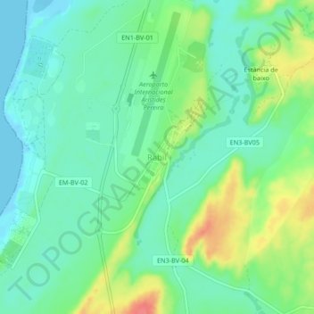
Name: Rabil topographic map, elevation, terrain.
Location: Rabil, Boa Vista, Cape Verde (16.10803 -22.90850 16.14803 -22.86850)
Average elevation: 21 m
Minimum elevation: -3 m
Maximum elevation: 66 m
Other topographic maps
Click on a map to view its topography, its elevation and its terrain.