
Veveyse topographic map
Interactive map
Click on the map to display elevation.
About this map
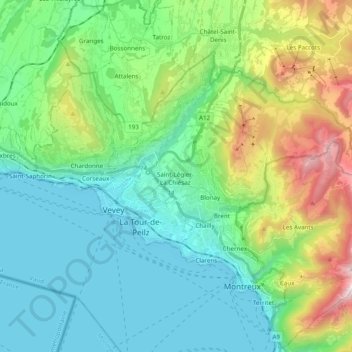
Name: Veveyse topographic map, elevation, terrain.
Average elevation: 742 m
Minimum elevation: 365 m
Maximum elevation: 1,802 m
Other topographic maps
Click on a map to view its topography, its elevation and its terrain.
Blonay
Switzerland > Vaud > District de la Riviera-Pays-d’Enhaut > Blonay - Saint-Légier
Blonay, Blonay - Saint-Légier, District de la Riviera-Pays-d’Enhaut, Vaud, 1807, Switzerland
Average elevation: 885 m