
Trešnjevka - sjever topographic map
Interactive map
Click on the map to display elevation.
About this map
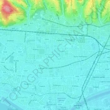
Name: Trešnjevka - sjever topographic map, elevation, terrain.
Location: Trešnjevka - sjever, Zagreb, City of Zagreb, 10110, Croatia (45.79387 15.90864 45.81032 15.96601)
Average elevation: 129 m
Minimum elevation: 109 m
Maximum elevation: 234 m
Other topographic maps
Click on a map to view its topography, its elevation and its terrain.