
Auburn topographic map
Interactive map
Click on the map to display elevation.
About this map
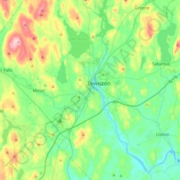
Name: Auburn topographic map, elevation, terrain.
Location: Auburn, Androscoggin County, Maine, 04210, United States (43.97407 -70.31624 44.19907 -70.17090)
Average elevation: 95 m
Minimum elevation: 28 m
Maximum elevation: 273 m