
River Chew topographic map
Interactive map
Click on the map to display elevation.
About this map
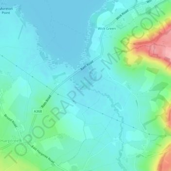
Name: River Chew topographic map, elevation, terrain.
Average elevation: 77 m
Minimum elevation: 53 m
Maximum elevation: 174 m
Other topographic maps
Click on a map to view its topography, its elevation and its terrain.
Chew Valley Lake
United Kingdom > England > Wick Green
Chew Valley Lake, A368, West Harptree, Wick Green, Bath and North East Somerset, South West England, England, BS39 5XR, United Kingdom
Average elevation: 67 m