
Slenaken topographic map
Interactive map
Click on the map to display elevation.
About this map
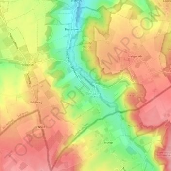
Name: Slenaken topographic map, elevation, terrain.
Location: Slenaken, Gulpen-Wittem, Limburg, Netherlands (50.75341 5.83474 50.78691 5.87653)
Average elevation: 193 m
Minimum elevation: 123 m
Maximum elevation: 242 m