
Jesseren topographic map
Interactive map
Click on the map to display elevation.
About this map
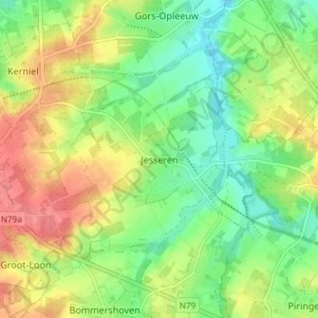
Name: Jesseren topographic map, elevation, terrain.
Location: Jesseren, Borgloon, Tongeren, Limburg, Flanders, 3724, Belgium (50.78587 5.37052 50.82587 5.41052)
Average elevation: 83 m
Minimum elevation: 53 m
Maximum elevation: 120 m
Other topographic maps
Click on a map to view its topography, its elevation and its terrain.