
Futuna topographic map
Interactive map
Click on the map to display elevation.
About this map
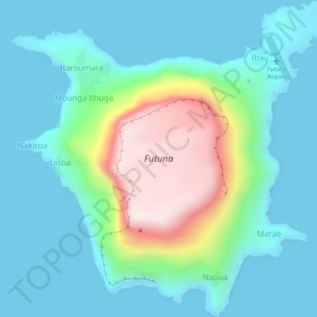
Name: Futuna topographic map, elevation, terrain.
Location: Futuna, Iasoa, Tafea, Vanuatu (-19.54949 170.19555 -19.50860 170.23826)
Average elevation: 149 m
Minimum elevation: -2 m
Maximum elevation: 656 m