
Lo Manthang topographic map
Interactive map
Click on the map to display elevation.
About this map
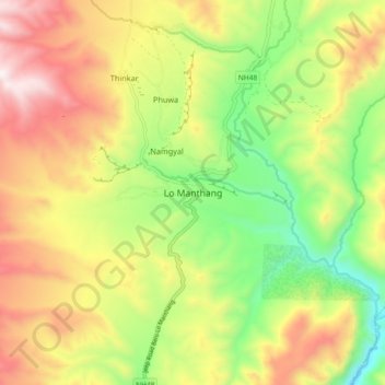
Name: Lo Manthang topographic map, elevation, terrain.
Location: Lo Manthang, Lomanthang, मुस्ताङ (Mustang), Gandaki, Népal (29.14270 83.91625 29.22270 83.99625)
Average elevation: 3,958 m
Minimum elevation: 3,518 m
Maximum elevation: 4,461 m