
Mocha topographic map
Interactive map
Click on the map to display elevation.
About this map
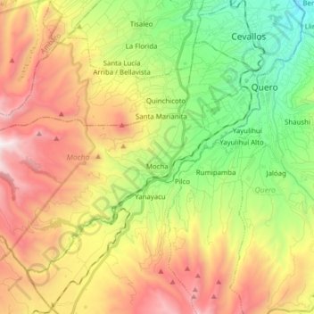
Name: Mocha topographic map, elevation, terrain.
Location: Mocha, Tungurahua, Ecuador (-1.47127 -78.76872 -1.35775 -78.61414)
Average elevation: 3,488 m
Minimum elevation: 2,676 m
Maximum elevation: 4,511 m
Concepción has a cool tropical rainforest climate (Af) due to altitude. It has very heavy rainfall year-round.