
Finney County topographic map
Interactive map
Click on the map to display elevation.
About this map
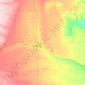
Name: Finney County topographic map, elevation, terrain.
Location: Finney County, Kansas, USA (37.73641 -101.10376 38.26356 -100.22544)
Average elevation: 883 m
Minimum elevation: 773 m
Maximum elevation: 988 m
Other topographic maps
Click on a map to view its topography, its elevation and its terrain.
Independence
USA > Kansas > Independence
Independence, Montgomery County, Kansas, 67301, USA
Average elevation: 245 m