
Oxford topographic map
Interactive map
Click on the map to display elevation.
About this map
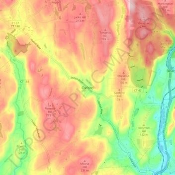
Name: Oxford topographic map, elevation, terrain.
Location: Oxford, New Haven County, Connecticut, 06478, USA (41.39518 -73.15728 41.47518 -73.07728)
Average elevation: 152 m
Minimum elevation: 18 m
Maximum elevation: 258 m