
Morat topographic map
Interactive map
Click on the map to display elevation.
About this map
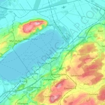
Name: Morat topographic map, elevation, terrain.
Location: Morat, District du Lac, Fribourg, Suisse (46.88224 7.08359 46.98633 7.19044)
Average elevation: 480 m
Minimum elevation: 423 m
Maximum elevation: 652 m