
Grand Bassa topographic map
Interactive map
Click on the map to display elevation.
About this map
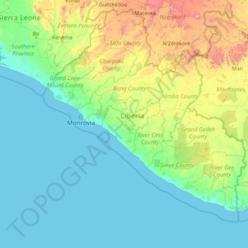
Name: Grand Bassa topographic map, elevation, terrain.
Location: Grand Bassa, Liberia (3.60406 -12.45567 8.72406 -7.33567)
Average elevation: 156 m
Minimum elevation: -1 m
Maximum elevation: 1,602 m
Other topographic maps
Click on a map to view its topography, its elevation and its terrain.
Zee
Liberia > Grand Bassa > District # 2
Zee, District # 2, Grand Bassa, Liberia
Average elevation: 94 m