
San Andrés Cholula topographic map
Interactive map
Click on the map to display elevation.
About this map
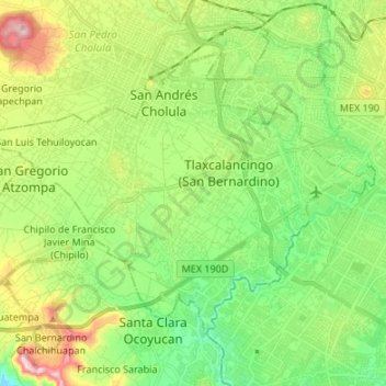
Name: San Andrés Cholula topographic map, elevation, terrain.
Location: San Andrés Cholula, Puebla, Mexico (18.97565 -98.35819 19.06850 -98.22386)
Average elevation: 2,136 m
Minimum elevation: 2,010 m
Maximum elevation: 2,378 m
Other topographic maps
Click on a map to view its topography, its elevation and its terrain.
Tlaxcalancingo (San Bernardino)
Mexico > Puebla > San Andrés Cholula
Tlaxcalancingo (San Bernardino), San Andrés Cholula, Puebla, 72821, Mexico
Average elevation: 2,123 m