
Reinosa topographic map
Interactive map
Click on the map to display elevation.
About this map
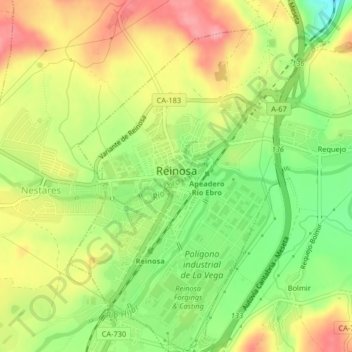
Name: Reinosa topographic map, elevation, terrain.
Location: Reinosa, Campoo-Los Valles, Cantabria, Spain (42.98561 -4.15039 43.01546 -4.12002)
Average elevation: 861 m
Minimum elevation: 805 m
Maximum elevation: 914 m
Other topographic maps
Click on a map to view its topography, its elevation and its terrain.
Mataporquera
Spain > Cantabria > Campoo-Los Valles > Valdeolea
Mataporquera, Valdeolea, Campoo-Los Valles, Cantabria, 39410, Spain
Average elevation: 954 m