
Courtallam topographic map
Interactive map
Click on the map to display elevation.
About this map
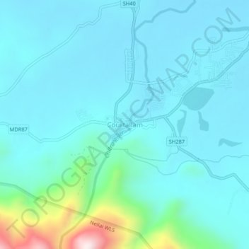
Name: Courtallam topographic map, elevation, terrain.
Location: Courtallam, Tenkasi, Tenkasi District, Tamil Nadu, 627802, India (8.91288 77.25146 8.95288 77.29146)
Average elevation: 239 m
Minimum elevation: 152 m
Maximum elevation: 768 m
Courtallam is a panchayat town situated at a mean elevation of 160 m (520 ft) in the foothills of the Western Ghats in Tenkasi district of Tamil Nadu, India. The Coutrallam Falls on the Chittar River is a major tourist attraction.
Other topographic maps
Click on a map to view its topography, its elevation and its terrain.
Kallorani
India > Tamil Nadu > Tenkasi > Kallorani
Kallorani, Tenkasi, Tenkasi District, Tamil Nadu, 627806, India
Average elevation: 158 m
Mathalamparai
India > Tamil Nadu > Tenkasi > Mathalamparai
Mathalamparai, Tenkasi, Tenkasi District, Tamil Nadu, 627814, India
Average elevation: 165 m