
Steyr topographic map
Interactive map
Click on the map to display elevation.
About this map
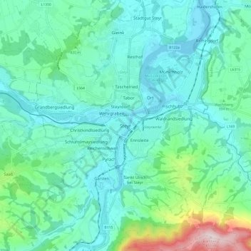
Name: Steyr topographic map, elevation, terrain.
Location: Steyr, Upper Austria, 4407, Austria (47.99900 14.37913 48.07900 14.45913)
Average elevation: 378 m
Minimum elevation: 279 m
Maximum elevation: 802 m