
Palmdale topographic map
Interactive map
Click on the map to display elevation.
Palmdale
Downtown Palmdale is located at 34°34′46″N 118°07′00″W / 34.57944°N 118.11667°W / 34.57944; -118.11667, at an elevation of 2,655 feet (809 m) above sea level.
About this map
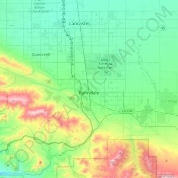
Name: Palmdale topographic map, elevation, terrain.
Average elevation: 898 m
Minimum elevation: 644 m
Maximum elevation: 1,662 m