
St Ives topographic map
Interactive map
Click on the map to display elevation.
About this map
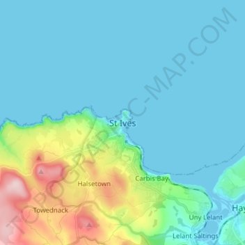
Name: St Ives topographic map, elevation, terrain.
Location: St Ives, South West England, England, TR26, United Kingdom (50.17489 -5.51956 50.25489 -5.43956)
Average elevation: 43 m
Minimum elevation: -1 m
Maximum elevation: 243 m
Other topographic maps
Click on a map to view its topography, its elevation and its terrain.
St Ives
United Kingdom > England > Huntingdonshire > St Ives
St Ives, Cambridgeshire, East of England, England, PE27 3YY, United Kingdom
Average elevation: 18 m