
Lindau (Bodensee) topographic map
Interactive map
Click on the map to display elevation.
About this map
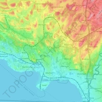
Name: Lindau (Bodensee) topographic map, elevation, terrain.
Location: Lindau (Bodensee), Landkreis Lindau, Bavaria, 88131, Germany (47.53366 9.63623 47.61207 9.74084)
Average elevation: 448 m
Minimum elevation: 391 m
Maximum elevation: 561 m