
Mandeville topographic map
Interactive map
Click on the map to display elevation.
About this map
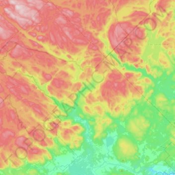
Name: Mandeville topographic map, elevation, terrain.
Location: Mandeville, D'Autray, Lanaudière, Quebec, J0K 1L0, Canada (46.32076 -73.55905 46.58622 -73.24093)
Average elevation: 340 m
Minimum elevation: 103 m
Maximum elevation: 605 m