
Yekaterinburg topographic map
Interactive map
Click on the map to display elevation.
About this map
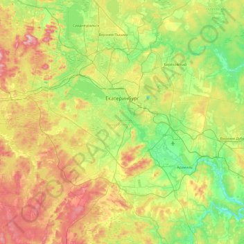
Name: Yekaterinburg topographic map, elevation, terrain.
Average elevation: 288 m
Minimum elevation: 190 m
Maximum elevation: 470 m
Other topographic maps
Click on a map to view its topography, its elevation and its terrain.
Chertovo Gorodishe mountain
Russia > Sverdlovsk Oblast > Yekaterinburg Municipality > Yekaterinburg
Average elevation: 284 m
Yekaterinburg
Russia > Sverdlovsk Oblast > Yekaterinburg Municipality > Yekaterinburg
Average elevation: 274 m