
Kielder topographic map
Interactive map
Click on the map to display elevation.
About this map
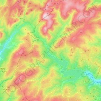
Name: Kielder topographic map, elevation, terrain.
Average elevation: 336 m
Minimum elevation: 127 m
Maximum elevation: 602 m
Other topographic maps
Click on a map to view its topography, its elevation and its terrain.
Kielder
United Kingdom > England > Northumberland > Kielder
Kielder, Northumberland, North East England, England, NE48 1EQ, United Kingdom
Average elevation: 276 m