
Dymchurch topographic map
Interactive map
Click on the map to display elevation.
About this map
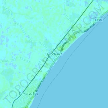
Name: Dymchurch topographic map, elevation, terrain.
Location: Dymchurch, Kent, South East, England, TN29 0PB, United Kingdom (51.00633 0.97365 51.04633 1.01365)
Average elevation: 1 m
Minimum elevation: -2 m
Maximum elevation: 6 m
England trails, hiking, mountain biking, running and outdoor activities