
Hanford topographic map
Interactive map
Click on the map to display elevation.
About this map
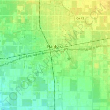
Name: Hanford topographic map, elevation, terrain.
Location: Hanford, Kings County, California, 93230, United States (36.26592 -119.69103 36.37189 -119.60082)
Average elevation: 73 m
Minimum elevation: 65 m
Maximum elevation: 82 m
The Hanford area was inhabited by the Tachi Yokut Indians for several thousand years prior to Euro-American contact. They occupied areas along watercourses such as creeks, springs and seep areas (such as sloughs), along perennial and seasonal drainages, as well as flat ridges and terraces. Therefore, the areas along streams are considered likely locations for prehistoric cultural resources. Permanent villages were usually placed on an elevation above the seasonal flood levels. Surrounding areas were used for hunting and seed, acorn, and grass gathering.
Other topographic maps
Click on a map to view its topography, its elevation and its terrain.
Corcoran
United States > California > Kings County
Corcoran, Kings County, CAL Fire Southern Region, California, 93212, United States
Average elevation: 62 m
Lemoore
United States > California > Kings County
Lemoore, Kings County, California, United States
Average elevation: 66 m
Tule River
United States > California > Kings County
Tule River, Kings County, CAL Fire Southern Region, California, United States
Average elevation: 59 m
Hanford
United States > California > Kings County > Hanford
Hanford, Kings County, California, 93230, United States
Average elevation: 74 m