
Cho Oyu topographic map
Interactive map
Click on the map to display elevation.
About this map
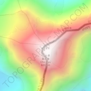
Name: Cho Oyu topographic map, elevation, terrain.
Average elevation: 7,339 m
Minimum elevation: 6,425 m
Maximum elevation: 8,172 m
Other topographic maps
Click on a map to view its topography, its elevation and its terrain.
Gyachung Kang
Nepal > Solukhumbu > Khumjung
Gyachung Kang, Khumjung, Khumbupasanglahmu, Solukhumbu, Province #1, Nepal
Average elevation: 7,006 m