
Soufrière Hills topographic map
Interactive map
Click on the map to display elevation.
About this map
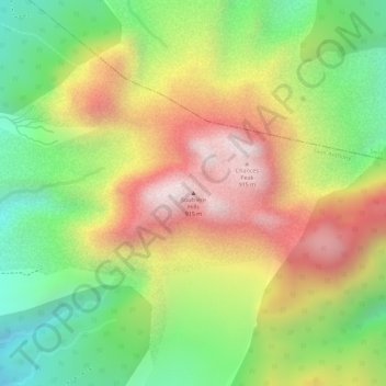
Name: Soufrière Hills topographic map, elevation, terrain.
Location: Soufrière Hills, Saint Anthony, Montserrat (16.70933 -62.17906 16.70943 -62.17896)
Average elevation: 553 m
Minimum elevation: 210 m
Maximum elevation: 902 m
Other topographic maps
Click on a map to view its topography, its elevation and its terrain.