
Goffs Oak topographic map
Interactive map
Click on the map to display elevation.
About this map
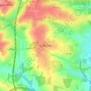
Name: Goffs Oak topographic map, elevation, terrain.
Average elevation: 74 m
Minimum elevation: 36 m
Maximum elevation: 116 m
Other topographic maps
Click on a map to view its topography, its elevation and its terrain.
Wormley
United Kingdom > England > Hertfordshire > Broxbourne
Wormley, Broxbourne, Hertfordshire, England, EN10 6DJ, United Kingdom
Average elevation: 39 m