
Langenlois topographic map
Interactive map
Click on the map to display elevation.
About this map
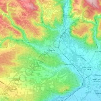
Name: Langenlois topographic map, elevation, terrain.
Location: Langenlois, Bezirk Krems, Lower Austria, 3550, Austria (48.43260 15.63630 48.51260 15.71630)
Average elevation: 281 m
Minimum elevation: 193 m
Maximum elevation: 437 m