
Baddington topographic map
Interactive map
Click on the map to display elevation.
About this map
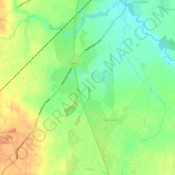
Name: Baddington topographic map, elevation, terrain.
Average elevation: 53 m
Minimum elevation: 34 m
Maximum elevation: 72 m
Other topographic maps
Click on a map to view its topography, its elevation and its terrain.
Austerson
United Kingdom > England > Hack Green
Austerson, Hack Green, Cheshire East, North West England, England, United Kingdom
Average elevation: 50 m