
Heather topographic map
Interactive map
Click on the map to display elevation.
About this map
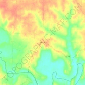
Name: Heather topographic map, elevation, terrain.
Location: Heather, Marion County, Missouri, 63439, United States (39.82254 -91.82739 39.86254 -91.78739)
Average elevation: 201 m
Minimum elevation: 170 m
Maximum elevation: 227 m